
Roopville, Georgia
Roopville, Georgia | |
|---|---|
 Downtown Roopville | |
 Location in Carroll County and the state of Georgia | |
| Coordinates: 33°27′24″N 85°7′52″W / 33.45667°N 85.13111°W | |
| Country | United States |
| State | Georgia |
| County | Carroll |
| Area | |
| • Total | 0.79 sq mi (2.05 km2) |
| • Land | 0.79 sq mi (2.05 km2) |
| • Water | 0.00 sq mi (0.00 km2) |
| Elevation | 1,247 ft (380 m) |
| Population (2020) | |
| • Total | 231 |
| • Density | 292.41/sq mi (112.95/km2) |
| Time zone | UTC-5 (Eastern (EST)) |
| • Summer (DST) | UTC-4 (EDT) |
| ZIP code | 30170 |
| Area code | 770 |
| FIPS code | 13-66696[2] |
| GNIS feature ID | 0321890[3] |
| Website | https://roopvillega.com/ |
Roopville is a town in Carroll County, Georgia, United States. The population was 231 in 2020, up from 218 at the 2010 census.[4]
History
[edit]Roopville was founded in 1881 by John K. Roop, and named for him.[5] The Georgia General Assembly incorporated Roopville as a town in 1885.[6]
Geography
[edit]Roopville is located in southern Carroll County at 33°27′24″N 85°7′52″W / 33.45667°N 85.13111°W (33.456731, -85.131219),[7] along U.S. Route 27, which leads 10 miles (16 km) north to Carrollton, the county seat, and south 6 miles (10 km) to Centralhatchee.
According to the United States Census Bureau, the town has a total area of 0.77 square miles (2.0 km2), all land.[4]
Demographics
[edit]| Census | Pop. | Note | %± |
|---|---|---|---|
| 1890 | 123 | — | |
| 1900 | 109 | −11.4% | |
| 1910 | 173 | 58.7% | |
| 1920 | 200 | 15.6% | |
| 1930 | 260 | 30.0% | |
| 1940 | 230 | −11.5% | |
| 1950 | 202 | −12.2% | |
| 1960 | 203 | 0.5% | |
| 1970 | 221 | 8.9% | |
| 1980 | 229 | 3.6% | |
| 1990 | 248 | 8.3% | |
| 2000 | 177 | −28.6% | |
| 2010 | 218 | 23.2% | |
| 2020 | 231 | 6.0% | |
| U.S. Decennial Census[8] | |||
As of the census of 2000, there were 177 people, 75 households, and 57 families residing in the town.[2] By the 2020 census, its population grew to 231.
Notable person
[edit]- Keith Jackson (1928-2018), sportscaster
Notable resident
[edit]- Donna Fiducia, News / Media Personality
References
[edit]- ^ "2020 U.S. Gazetteer Files". United States Census Bureau. Retrieved December 18, 2021.
- ^ a b "U.S. Census website". United States Census Bureau. Retrieved January 31, 2008.
- ^ "US Board on Geographic Names". United States Geological Survey. October 25, 2007. Retrieved January 31, 2008.
- ^ a b "Geographic Identifiers: 2010 Demographic Profile Data (G001): Roopville town, Georgia". U.S. Census Bureau, American Factfinder. Archived from the original on February 12, 2020. Retrieved July 18, 2014.
- ^ Memoirs of Georgia. Southern Historical Association. 1895. p. 439.
- ^ Acts Passed by the General Assembly of Georgia. J. Johnston. 1885. p. 391.
- ^ "US Gazetteer files: 2010, 2000, and 1990". United States Census Bureau. February 12, 2011. Retrieved April 23, 2011.
- ^ "Census of Population and Housing". Census.gov. Retrieved June 4, 2015.
Municipalities and communities of Carroll County, Georgia, United States | ||
|---|---|---|
| Cities | 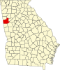 | |
| Towns | ||
| CDP | ||
| Other unincorporated communities | ||
| Ghost town | ||
| Footnotes | ‡This populated place also has portions in an adjacent county or counties | |